A new plan rolled out in late 201 by the New York Economic Development Corporation and the Mayor's Office of Climate Resiliency aims to protect Lower Manhattan from future floods.
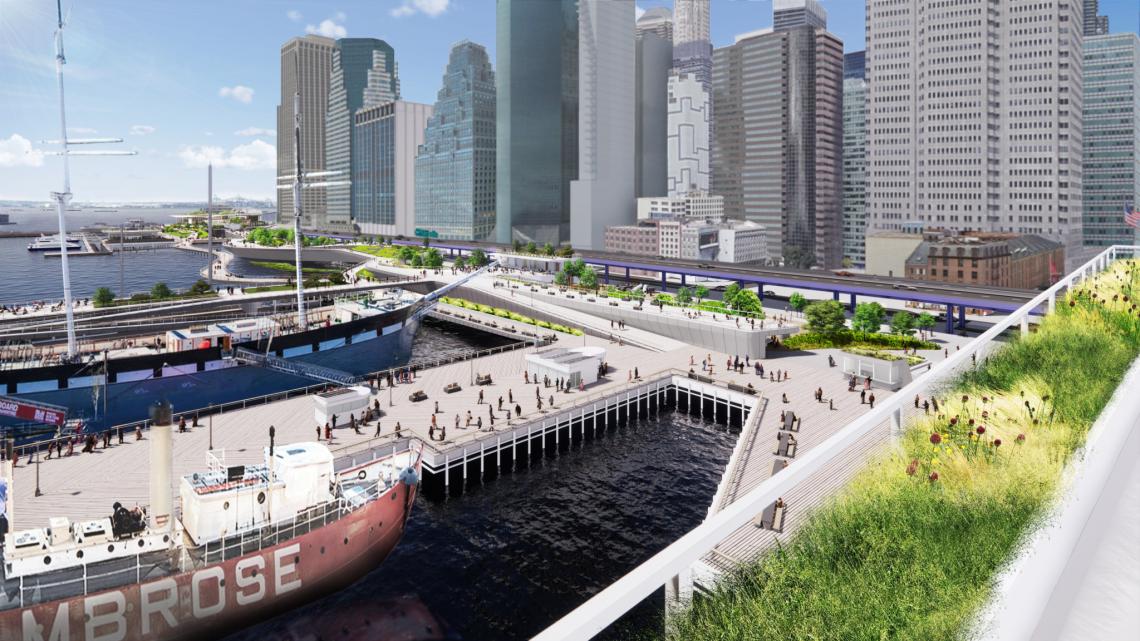 View looking south from Pier 17New York City Economic Development Corporation
The Financial District and Seaport Climate Resilience Master Plan, billed as "a shared City-community vision for a resilient 21st-century waterfront," aims to protect a part of the Manhattan which is particularly vulnerable to flooding both as a result of storms and climate change. It also one of the region's key economic drivers.
"Lower Manhattan is at the core of New York City’s transportation system, economy, and civic life," notes the plans website. "It also serves as both a destination and gateway for residents, workers, and visitors from across the city, region, and world. Millions of people travel through Lower Manhattan by rail, bus, car, and ferry every day, and people and goods flow through the area’s highways, tunnels, and bridges. With over 415,000 daily subway and PATH (Port Authority Trans-Hudson) train riders, and 93,000 daily ferry riders, Lower Manhattan provides connections across all five boroughs and to other regional centers like Midtown, Jersey City, and Downtown Brooklyn."
The plan focuses on a one-mile section of the Lower Manhattan shoreline between The Battery and the Brooklyn Bridge, where low-lying terrain and a complex of subway and vehicular tunnels, underground utility lines, and and elevated highway create additional vulnerabilities, as well as complications for constructing protective infrastructure.
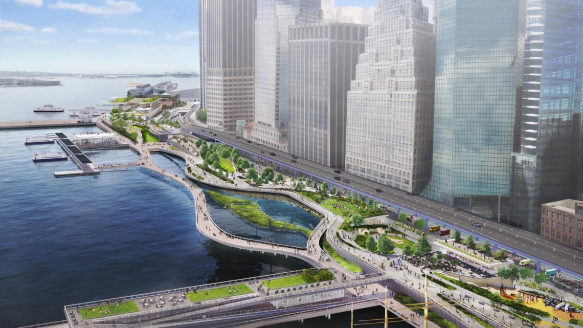
 View from Pine Street Cove looking northNew York City Economic Development Corporation
With limited space available along the waterfront, the City's proposal calls for extending Lower Manhattan's shoreline into the East River, creating room for flood defense infrastructure, which also doubles as public open space. The resulting plan calls for a multi-level structure integrating a flood wall and floodgates with greenery with pathways and platforms offering view of the skyline and the water.
Construction of the full range of improvements envisioned in the plan could cost between $5 billion and $7 billion.
“This Plan for a protected and resilient waterfront in Lower Manhattan will help us fully confront the urgent and accelerating threat of climate change,” said Mayor Bill de Blasio in a statement. “A recovery for all of us must ensure families, businesses, and communities in Lower Manhattan are able to withstand extreme weather and rising sea levels, which this vision guarantees.
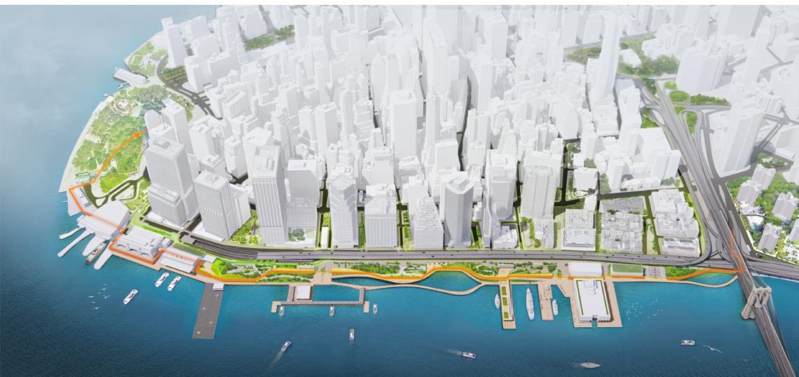
 Aerial view of the waterfrontNew York City Economic Development Corporation